Bereket
Bereket, formerly Gazanjyk or Kazandzhik (Казанджик or Газанҗык gɑˈzɑnd͡ʒik), is a city in Balkan Province in western Turkmenistan. Bereket is the administrative centre of Bereket District.
Bereket is located in an oasis in the foothills of the Kopetdag Mountains and on the edge of the Karakum Desert.
Bereket is a strategic junction of the Trans-Caspian Railway (Caspian Sea-Turkmenistan-Uzbekistan-Kazakhstan) and North-South Transnational Railway (Russia-Kazakhstan-Turkmenistan-Iran-Persian Gulf.
The city has a large locomotive repair depot and a modern railway station.
The city is located approximately 260 km west of the Turkmen capital of Ashgabat and 340 km east of the Caspian Sea port of Turkmenbashy. The largest cities nearby are Balkanabat 120 km to the west, and Serdar 90 km to the east.
The estimated population of the city is 24,500 as of March 2015.
Gazanjyk is probably derived from the Turkic language word gazan or kazan (meaning a large cooking pot used throughout Central Asia, roughly equivalent to a cauldron) and -jyk, a suffix to denote "small in size". The name can be translated into English as "small cauldron". Atanyyazow notes that Gazanjyk is the name of a spring near the city, and it was named after its shape.
On 29 December 1999, by Parliamentary Resolution XM-66, the city and district (etrap) of Gazanjyk were renamed Bereket. Bereket means in the Turkmen language abundance or prosperity. The word bereket is borrowed from the Persian word Barakat (برکت), which in turn is borrowed from the Arabic Barakah (برکة).
Map - Bereket
Map
Country - Turkmenistan
 |
 |
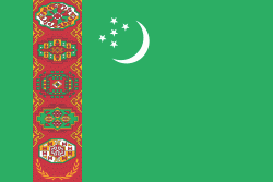
| Flag of Turkmenistan | |
Turkmenistan has long served as a thoroughfare for other nations and cultures. Merv is one of the oldest oasis-cities in Central Asia, and was once the biggest city in the world. It was also one of the great cities of the Islamic world and an important stop on the Silk Road. Annexed by the Russian Empire in 1881, Turkmenistan figured prominently in the anti-Bolshevik movement in Central Asia. In 1925, Turkmenistan became a constituent republic of the Soviet Union, the Turkmen Soviet Socialist Republic (Turkmen SSR); it became independent after the dissolution of the Soviet Union in 1991.
Currency / Language
| ISO | Currency | Symbol | Significant figures |
|---|---|---|---|
| TMT | Turkmenistan manat | m | 2 |
| ISO | Language |
|---|---|
| RU | Russian language |
| TK | Turkmen language |
| UZ | Uzbek language |


